Due to the oddity of train timetables and my attempt to make the most of the day, Episode 15 of Exploring the East Coast actually started midway through Episode 16, with me catching a train from East Linton. A short ride four stations back down the East Coast Mainline (ECML) brought me to Wallyford, the first of two stations being covered in this episode and from where I could to the other, Musselburgh.

Unfortunately, I missed out on visiting the village of Wallyford itself, mainly through stupidity and believing that the housing estates at the end of Musselburgh were Wallyford and not realising the village itself was the other side of the railway. However, having had a look at Google since, it doesn’t seem I missed much with the village having a pretty church and a memorial stone to the Battle of Pinkie Clough, but otherwise being a pretty standard small village.
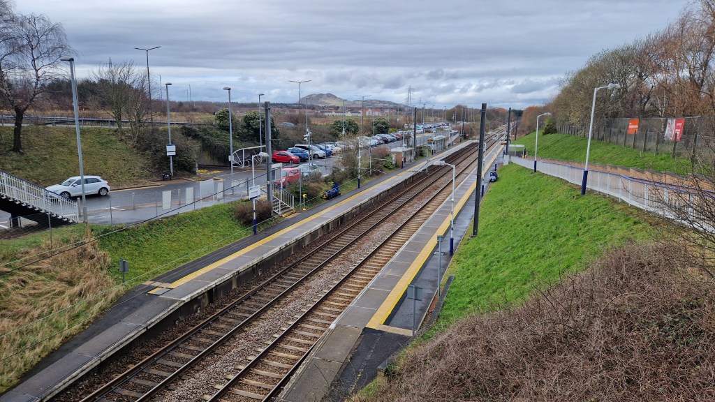
Wallyford station, like many on this section of the ECML is served by the hourly ScotRail between Edinburgh Waverley and North Berwick. During peak hours this increases to a half hourly service and it is further supplemented by the half a dozen trains between Edinburgh and Dunbar. Wallyford station is actually ‘relatively’ new compared to the ECML, with the current station opening in 1994 and replacing a station that was open for just 16 months during the mid 1860s.

I left Wallyford station via the exit on the northern side of the railway and made my way through the Pinkie area of Musselburgh until I reached Levenhall Links, a 134 hectares area of land reclaimed from the sea. Home to Musselburgh Racecourse and Musselburgh Old Course Golf Club, Levenhall Links is also the site of the Musselburgh Lagoons, a number of fly ash lagoons which provide a great habitat for wading birds and other wildlife.
Whilst the weather was not on my side and the exposed area close to the seafront meant I was being blasted by a sea breeze, I did enjoy a walk around Levenhall Links taking in one of the lagoons, some of the wooded area and covering the length of the racecourse. Walking past the golf course’s clubhouse made me chuckle as the first tee requires golfers to ‘launch’ the ball across the footpath and racecourse, making me hope they suspend golf on race days. Making my way out past the grand buildings of the racecourse’s hospitality, I headed along some more of Musselburgh’s back streets towards the River Esk.

Just before reaching the river I reached what was marked on Google as St. Andrew’s High Church, however seemed to be more of a school house or large residential building. Seemingly once again my stupidity got the better of me and this was the rear of the building and part of the church hall (possibly the former vicarage) whilst the main church building was accessible via the High Street. Unfortunately, I didn’t realise this at the time and so my only view of the church was of the church hall.
The River Esk flows for about 25-30km through Mid and East Lothian before it completes its journey to the sea through Musselburgh. Lots of work is currently taking place on the banks of the river through the town and the area around its mouth to improve flood defences, although there is still plenty of open and green space along the banks. In one of these riverside parks is the Musselburgh Archer, one of two pieces of art working funded by Tesco as part of their planning permission for expansion in the area.
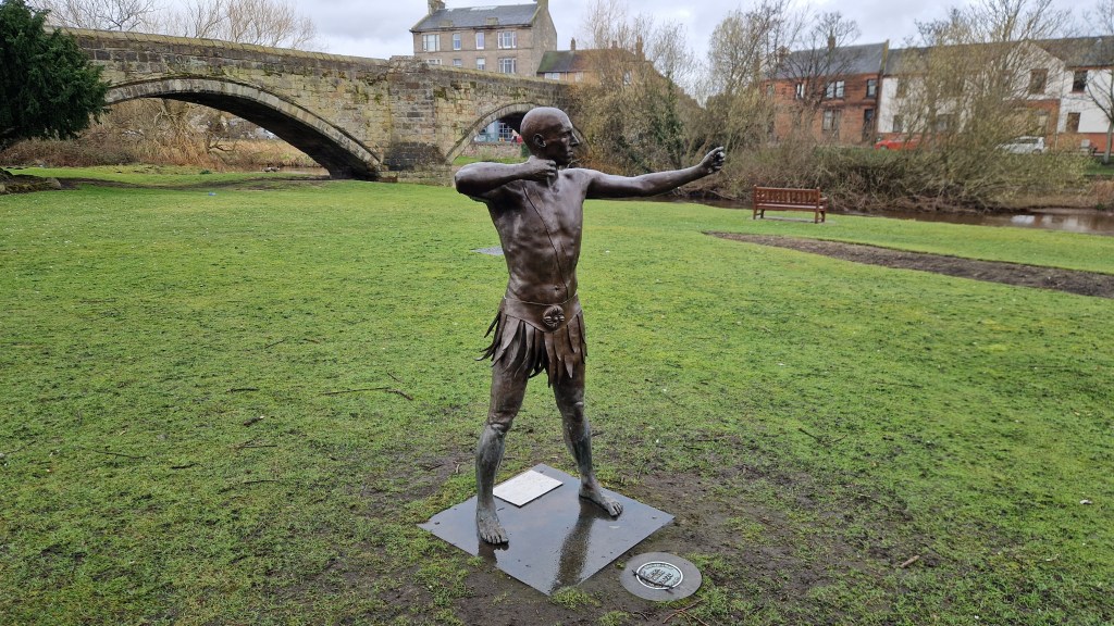
The Musselburgh Archer supposedly represents three key pieces of Musselburgh’s history: Roman occupation of the area; the Battle of Pinkie Clough; and the Musselburgh Silver Arrow competition. The Archer is in fact missing their arrows, with these placed in a trail around the town taking in key historical sites. Each arrow is also engraved with a ‘wish’ for the future of the town. From the Musselburgh Archer, I continued my route towards the station, gradually climbing up above the river and eventually heading away from it through another of the town’s housing estates.
The railway line at Musselburgh station marks the boundary between the Monktonhall area of the town and the Queen Margaret University campus. The station sees an identical service to Wallyford, mainly being served by the Edinburgh to North Berwick services, although has high-speed non-stop LNER, TPE, Lumo & CrossCountry services passing through, and has fairly limited facilities with just a waiting shelter on each platform and a ticket machine on platform 2.
Unfortunately, my route through Musselburgh didn’t really take me onto the western side of the River Esk, where you can also find Fisherrow Harbour, Musselburgh Beach and the National Trust of Scotland’s Newhails Estate. Musselburgh has plenty to explore, but is quite spread out and so visiting by train can involve a lot of walking. You’re also a lot better off starting any walk from Musselburgh station and heading towards Wallyford as this will reduce the number and severity of the uphill sections to the walk.

One thought on “Exploring the East Coast – Wallyford & Musselburgh”